A rockfall barrier can catch debris yet leave a mountain route unsafe. The impact may damage the barrier, block the carriageway or track, or cut off the crew needed to inspect it. Where alternative routes are scarce, engineers must consider how the corridor detects a disruption, stops traffic and recovers—not just how the barrier performs. That distinction affects inspection priorities, protection works and operating procedures.
Define the corridor as a connected system
Mountain roads and railways often pass cut slopes, embankments, retaining structures, bridges, tunnels and drainage works within short distances. Failures can propagate between them. Debris from a slope may plug a culvert; backed-up water can saturate an embankment; a damaged approach can isolate an otherwise serviceable bridge. Assessment needs an asset register and a corridor map showing where one failure could disable another element.
Start with route continuity. Identify junctions, sidings, passing places, emergency access points and feasible detours. Record the constraints on each: vehicle or train type, gradient, clearance, seasonal availability and response time. A nominal alternative is no diversion if it cannot carry the required traffic or is exposed to the same storm. A blocked rail section may strand a train between stations; a road closure may prevent crews from reaching damage from the expected direction.
Choose the unit of analysis to fit the decision. An individual culvert is suitable for planning inspection or repair. A group of slopes above one exposed kilometre is more useful for setting weather-related operating controls. The whole corridor is the right scale for judging service loss and emergency access. A well-maintained asset cannot compensate for a network bottleneck elsewhere.
Separate hazard, exposure and consequence
The steepest slope is not necessarily the highest priority. What matters is whether material can reach the alignment, who may be there, and what follows if service stops. A screening record should distinguish:
- Hazard: the type and plausible extent of rockfall, debris flow, snow movement, flooding, ground deformation or seismic damage at the location.
- Exposure: which assets and users occupy the affected area, including maintenance crews during inspections and clearance.
- Vulnerability: how the roadbed, track, structure or protective work could respond to the event.
- Consequence: likely interruption, access restrictions, repair difficulty and effects on connected services.
Record uncertainty, too. Limited slope visibility, an incomplete drainage inventory or a lack of observations after extreme weather should qualify a rating, rather than produce a precise-looking probability. Field evidence and event histories can refine a detailed assessment; a single score cannot replace them.
Find failure chains, not just hazardous locations
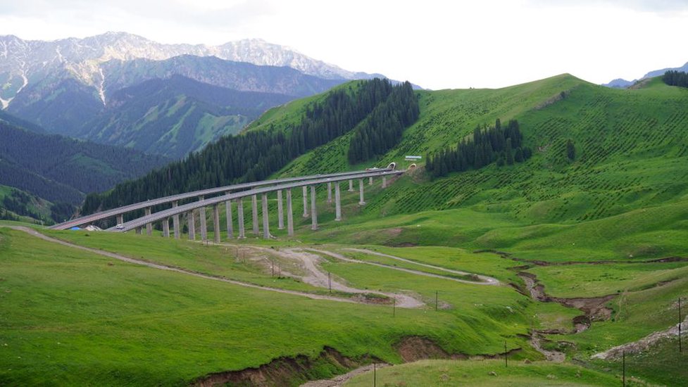
Mountain terrain channels water and falling material past several assets. A blocked hillside channel might redirect runoff over a tunnel portal, along a retaining wall and onto a bridge approach. Tracing the path from source to receiving asset tells engineers more than a separate list of structures.
Field teams can document flow lines, deposits, scour marks, loose blocks, vegetation disturbance and signs of past maintenance. They should look above and below the alignment. A stable-looking cut face does not rule out debris from an upper catchment, while erosion below a road can remove support before a surface defect appears. Aerial imagery and terrain models help connect observations, but canopy, snow cover and resolution limits still make site verification important.
Incident histories help when locations and conditions are recorded consistently. An entry that says only “slide cleared” cannot show whether repeated blockages share a source area, follow heavy rain or reflect inadequate conveyance. More useful records include the affected chainage, material type, approximate extent, weather conditions, damaged assets, operating restriction and, where safe, photographs taken before clearance.
Compare unlike events with care. A rockfall that rarely reaches the track and a small, frequent drainage blockage may call for different controls even if both have caused closures. The first may warrant source-area investigation and impact protection; the second may call for better access, debris management and inspection timing. Choosing slope stabilization or landslide treatment requires site-specific geotechnical work, not a corridor ranking alone.
Make observations usable for operations
Monitoring has safety value when an observation leads to a defined decision. Rain gauges, stream levels, movement measurements, cameras and patrol reports capture different parts of an evolving event. Rainfall may indicate conditions favorable to failure, but it cannot confirm that a particular slope has moved. A movement sensor can show local displacement while missing an adjacent release. A camera may show debris on the route with little advance warning.
At each monitored location, operators need to know the expected failure mode, what area the device measures, data latency, power and communications dependencies, and the response if reporting stops. Thresholds should draw on local evidence and be reviewed after events; a rainfall trigger copied from another catchment can give false confidence. Alert procedures need a named recipient, a way to acknowledge the alert and a pre-agreed action—inspection, speed restriction, traffic hold or closure—as appropriate to the asset and operating authority.
Distinguish warning of conditions from confirmation of obstruction. The first can prompt precautionary controls before a release; the second can prevent traffic entering an affected section. Neither removes the need to check nearby bridges, culverts or slopes after an event. The control room should also be able to see sensor health: silence during a storm is not evidence of a clear route.
Weather-based inspections need the same discipline. Specify which sites are checked after intense rain, rapid thaw or earthquake shaking, which access routes remain viable and which observations require escalation. Crews should not be sent beneath an active slope solely to verify a remote alert. If direct access is unsafe, observation from a protected location or a temporary operating restriction may be warranted until conditions change.
Protect transitions and interfaces
Asset boundaries often warrant closer attention than central spans or sections. Settlement or washout at a bridge approach can cause an abrupt loss of support while the bridge remains intact. At a tunnel portal, runoff, falling debris and retaining structures meet traffic in a confined space. At a cut-to-fill transition, changes in water conditions and stiffness may produce recurring pavement or track-geometry defects. Inspection plans should name these interfaces rather than leave them divided between asset teams.
Drainage connects many of these problems. Inspectors need to ask where water goes if an inlet blocks, overtops or erodes around its outlet—not simply whether it is open on inspection day. A clear culvert does not establish how it will perform in a debris-laden storm. Outlet scour, sediment deposits and redirected surface flow may expose a system problem before damage appears on the carriageway or track.
Protective structures need inspection against their intended function. A barrier that has intercepted debris may have lost some capacity; a catch ditch may still be present but full. After an impact, record the event, inspect anchorage and deformation, and check the remaining interception path rather than marking the structure merely “in place.” Competent evaluation of the installation and impact evidence is needed to judge design capacity and any repair or reuse decision.
Prioritize work by risk reduction and recoverability
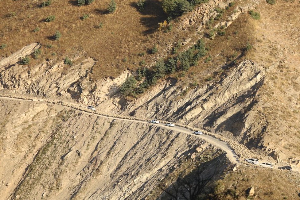
A corridor program must choose among inspection access, maintenance, protective works, structural repairs and operating controls. Hazard size alone is a poor guide. A modest problem at the sole accessible bridge may disrupt more service than a larger hazard on a section with a practical diversion. Equally, severe consequences do not justify an intervention that will not work.
For each proposed action, document the failure chain it addresses and its effect on three separate outcomes: the chance of an incident, the chance that traffic encounters it and the time needed to restore safe operation. Clearing a debris trap may reduce overtopping. A dependable detection and stop procedure may reduce exposure without preventing a release. Safe access and available replacement components may shorten a closure. Those benefits are not interchangeable.
Check dependencies before claiming risk reduction. A remote alarm that relies on one communications route may fail during the event that blocks the alignment. Regional flooding may close the planned diversion. A barrier may protect moving traffic but leave crews no safe place to remove retained debris. Tests and exercises should include these shared failure modes, communications loss and simultaneous incidents.
Documented scenarios offer a clearer basis for comparing options than a precise-looking score. Describe what would happen if a culvert were obstructed during heavy rain: whether water would cross the route, how quickly the blockage could be identified and whether crews could approach from either side. Compare proposed actions against that same scenario. Cost, constructability, ecological constraints and maintenance access still matter, alongside demonstrable safety and service effects.
Turn closure and reopening into engineering decisions
Stopping traffic may be the main available protection. Reopening needs an equally clear basis. Removing visible debris does not show that an upslope source has stabilized or that the supporting formation is intact. A bridge may look passable from its deck while scour or bearing damage remains unseen. Inspection scope should follow the event mechanism and cover assets that may have been affected indirectly.
Procedures should distinguish initial reconnaissance, detailed assessment where warranted, temporary restrictions and return to normal operation. Set roles before an event: who orders a closure, who assesses the site, who approves restricted reopening and how findings reach dispatchers and maintenance teams. Rail operators may need to check track geometry, signaling and traction infrastructure alongside earthworks. Road operators may need to assess barriers, surface condition and response-vehicle access.
Keep the evidence behind the closure and reopening decision after clearance. Time-stamped photographs, inspection locations, instrument readings, traffic restrictions and repair records support later review. If access was limited or a source area could not be observed, record that limitation and the control used to manage it. Repeated temporary reopenings at one location should prompt investigation of the underlying failure chain, not another clearance order.
Keep the corridor model current
A network assessment ages as slopes weather, vegetation changes, drainage fills and repairs alter asset behavior. Supplement scheduled inspections with updates after significant events and construction work. Revise the corridor map when crews find new debris paths, access arrangements change or monitoring equipment goes out of service.
Consistent location references make those updates useful across disciplines. A slope team may name a catchment, a bridge team an asset number and an operator a route section; each needs a shared reference for the same place. At the next inspection of a recurring blockage, record both its route chainage and its upslope drainage path. That evidence can show whether crews are clearing an isolated inlet or dealing with a wider catchment problem.