A culvert may carry its design flow and still leave a road impassable. Debris can block the inlet, forcing water around the embankment instead. That failure involves more than drainage capacity: runoff routes, sediment supply, maintenance access and the consequences of overtopping all matter. Disaster-resistant design has to examine what happens when several parts of this system are stressed at once.
Start with the corridor, not the pavement
Alignment comes first. The road’s position relative to floodplains, unstable slopes, drainage networks and potential ground deformation determines much of its exposure. Moving it away from a hazardous reach may be more effective than strengthening every component there, though the change can shift impacts elsewhere. Screening must also cover construction access and temporary drainage. A sound permanent alignment does not make an exposed construction stage safe.
Hazard maps provide a starting point, but a site model needs evidence of how failure could occur. Historical washouts, channel changes, landslide signs, groundwater conditions and maintenance records help establish whether a mapped hazard has a credible mechanism. Where records are sparse, state the uncertainty rather than burying it in a single assumed event.
Test combinations and consequences
A useful scenario identifies the loading, the component likely to fail and the resulting disruption. Heavy rain may saturate a cut slope while carrying debris into its ditch. An earthquake could damage a bridge approach and block the only diversion route. Extreme heat followed by intense rainfall may also allow rapid water entry through cracks and joints. These combinations need not be equally likely; testing them exposes dependencies that separate component checks can miss.
Consequence matters as much as hazard. A short closure where a reliable alternative exists is different from a washout that isolates a community or blocks emergency access. Identify which links must remain usable, which can close safely and which need a workable recovery route. Those decisions inform redundancy, tolerable damage and inspection access; they do not imply that every road must remain open through every event.
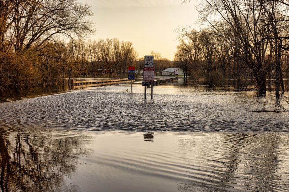
Design water pathways, including failure pathways
Flood resilience is not just a matter of sizing pipes and ditches. At each crossing, trace the upstream flow path, debris sources and possible inlet blockage. Then examine outlet erosion, embankment overtopping and where diverted water would go. A low point that releases excess water at a controlled location may be preferable to water flowing unexpectedly along the road, but that choice requires site-specific hydraulic, geotechnical and safety assessment.
Surface drainage and subsurface support are linked. Water held against a pavement edge can weaken underlying layers even if the carriageway never floods. On slopes, poorly directed discharge can erode ground below an outlet or increase infiltration into an already marginal soil mass. When material is being lost, diagnosing erosion at roads, railways and bridges before repair helps separate the cause from its visible symptoms.
Historical observations describe past conditions; future rainfall and coastal water levels may change how often, or how long, a road is exposed. Test several credible scenarios, including one beyond the selected design event, to see whether failure would develop gradually or arrive abruptly and prove difficult to repair. Document the scenario range and the residual risk accepted by the road owner.
Keep slopes, earthworks and structures working together
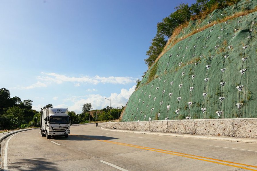
Embankments and cuttings fail in different ways: exposed surfaces erode, a slope loses toe support, pore-water pressures rise, or ground moves along a weak layer. A condition survey should distinguish these mechanisms before protection is chosen. Vegetation, surface armoring, drainage, changes to earthwork geometry and retaining structures address different parts of the problem. None is a universal slope fix.
At a river crossing, the road, approach fill, abutments and channel act as one system. Scour or erosion can remove support from an approach while the bridge itself remains sound. Floodwater may also leave debris where inspection or repair vehicles need to reach the structure. A design review should trace the load path and the route crews would use to assess damage after an event.
Seismic areas call for a different assessment. Shaking, settlement, liquefaction and lateral spreading can affect neighboring road elements unevenly; an approach may settle relative to a bridge and interrupt service without a collapse. Choosing measures requires local ground investigation and deformation analysis. Stronger pavement alone cannot correct unstable support.
Make resilience verifiable and maintainable
Connect each measure to evidence
Record what each design option is meant to do and how that function will be checked. For a drainage crossing, this may involve checking predicted water levels and flow routes, then confirming inlet geometry and downstream protection during construction. For a slope, compare the ground model with exposed conditions and monitor movement or groundwater where uncertainty warrants it. Construction deviations deserve attention: relocating an outlet can change the erosion mechanism the design was intended to control.
Four questions keep disaster scenarios tied to decisions rather than a catalogue of products:
- What initiates the failure? Identify the flood path, ground movement or blockage that loads the asset.
- What fails first? Include approaches, shoulders, outlets and access routes, not just the main structure.
- How is damage detected? Specify observations crews can make safely after the event.
- What restores service? Consider isolation, temporary access, repair materials and inspection needs before reopening.
Maintenance belongs in the design basis. An inlet that needs frequent clearing requires safe access and an inspection plan; a buried drain needs a means of checking whether it still works. After a disaster, reopening criteria should reflect the suspected failure mechanism. A clean pavement surface cannot rule out voids beneath an approach or continued movement of a saturated slope.
For a crossing with a history of debris accumulation, the handover record can identify the upstream debris source, expected overflow path, inlet features to inspect and locations where erosion would indicate lost support. Those observations give the first post-storm inspection a defined purpose before anyone decides to reopen the road.