
A raised patch of pavement beside a bus stop might mark a utility repair, a tree root or a change in the ground beneath the street. Without records, you cannot tell which. That distinction makes a familiar walking route useful: you can observe how the street is built and maintained without mistaking a visible clue for an explanation.
Choose a compact area you can reach on foot or by public transit, then give the outing one theme: drainage, bridge approaches, pedestrian crossings or changes in pavement. A focused route is more revealing than trying to cover the whole city, and easier to budget for. Check fares, carry water and stick to publicly accessible spaces rather than paid attractions.
Start with a route you can actually finish
For a first walk, connect three or four public places within a manageable distance. A library, riverside path, transit stop and public square can take you past different streets and structures without an admission fee. Check an official map or transit timetable beforehand, particularly if the return service is infrequent. A public library may also have local maps or historical material, though availability varies.
Plan a shorter option. Weather, construction closures and uneven paths can make the walk harder than expected; a route passing several transit stops lets you stop early. In an unfamiliar area, go in daylight and confirm that paths are open to pedestrians. A line on a map does not guarantee public access.
- Pick a theme: start with one question, such as where stormwater goes after it leaves the street.
- Set a spending limit: allow for transit fares and a small contingency, not just admission costs.
- Mark rest points: note public seating, toilets and places to refill water where available.
- Check conditions: rain, heat, ice and temporary works can make a simple walk unsuitable.
Let the street explain its own design
Follow water, not just landmarks
After rain, street gradients become easier to read. From a safe pedestrian position, watch whether water flows toward an inlet, collects at a low point or crosses a walking route. A tree-lined block and a paved square may have different visible drainage features because their surfaces and surrounding uses differ. Stay out of flooded areas and do not lift covers: standing water can hide holes, debris and electrical hazards.
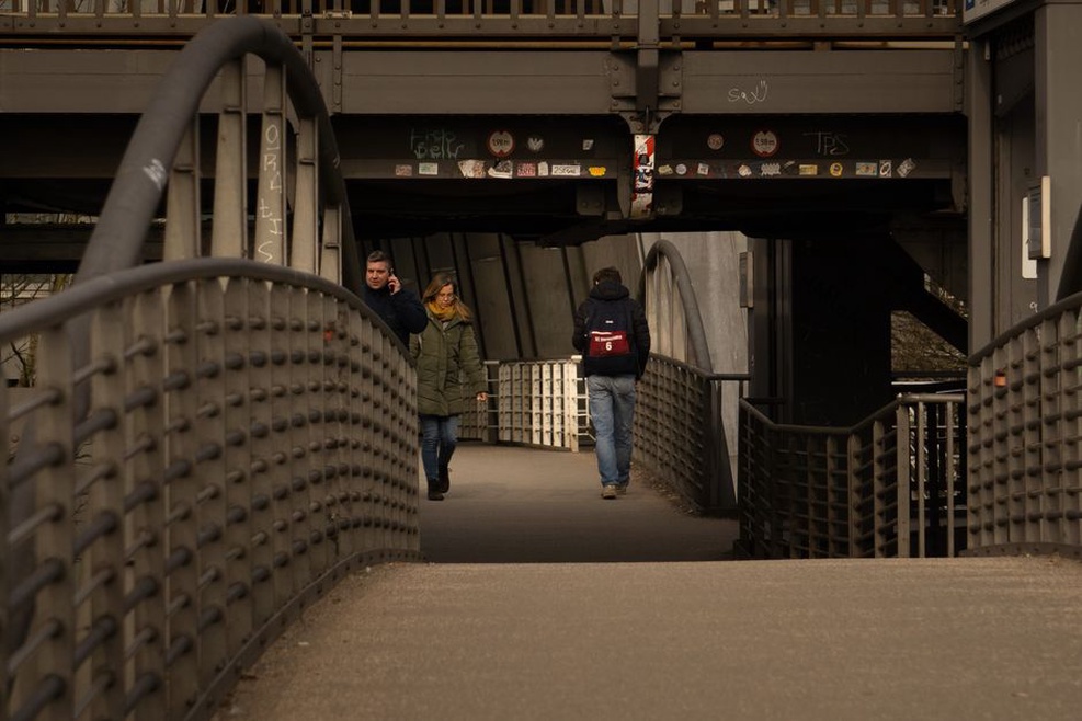
At a bridge or underpass, look for where runoff from the deck or approach appears to go, and whether it crosses the pedestrian route. Staining or dampness is worth noting, but it is not a diagnosis of structural condition. A photograph paired with a note about recent weather is more useful than a confident guess about the cause.
Notice transitions underfoot
Changes in paving material, repaired utility trenches and joints near bridges show where parts of a transport corridor meet. Check whether the walking surface stays even across each transition and whether water crosses it. Compare similar features on two streets before drawing conclusions. Construction history, ground conditions, traffic and maintenance practices can all affect what is visible.
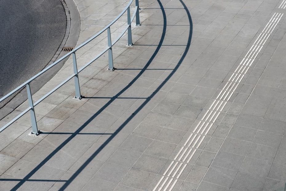
Accessibility offers another way to read the route. At crossings, note where curb ramps, tactile paving and pedestrian signals sit, then look beyond the crossing for a clear path. A ramp that seems well placed on one side may lead to an obstruction on the other. Observe from the public path; do not assume a brief visual check establishes compliance or attempt to test a facility on behalf of other users.
Use free records to add context
Public maps, historic photographs, planning documents and street-works notices can help explain what you saw. Their availability and detail vary, and some require a library or archive visit. Comparing older and newer records might show that a rail corridor became a path or that a road crossing changed shape. It will not, on its own, tell you why engineers chose the design.
Begin with one question from the walk. If a retaining wall borders an old rail alignment, a historic map may help establish when the line existed. If a crossing appears recently altered, a public works notice may describe the project scope. Check each record’s date and purpose: an old map shows an earlier layout, while a proposed plan may never have been built.
Free public talks and exhibitions can add context. Museums, universities, libraries and transport agencies sometimes hold events on local development or infrastructure. Check whether booking is required and whether entry to the venue carries a charge.
Compare two neighborhoods without turning it into an inspection
You need not travel far to make a useful comparison. Walk two short corridors of similar length, perhaps one beside a major transit route and another on a quieter residential street. Record only what you can observe: crossing spacing, seating, shade, surface changes and how pedestrians get around work zones. Do not rank infrastructure condition after a casual visit. Establishing maintenance needs calls for appropriate access, records and investigation.
Look at how each feature connects to its surroundings. An underpass may shorten a route, but only if its approaches are accessible and people can find the entrance. A wide footway can narrow abruptly at a utility cabinet. Watching how the route works, while keeping clear of other pedestrians, often tells you more than photographs of isolated structures.
Keep the outing safe, lawful and inexpensive
Stay on public paths and behind barriers, especially near rail lines, bridges, tunnels and active works. Do not cross a barrier for a better view. Follow signs restricting photography in security-sensitive areas, and respect the privacy of people using the route. If something appears hazardous, report it through the relevant public channel rather than touching it or attempting a repair. Give the location precisely and describe what you observed, not what you assume caused it.
Keep field notes simple: location, time, weather, feature and a question to check later. A phone works well, but paper is useful when battery power or mobile coverage is limited. Make uncertainty explicit. “Water pooled near inlet after rain” is better than “inlet blocked” if you have not verified the cause. If it is awkward to take notes where you are, move to a safe stopping point first.
For a two-hour outing, link a transit stop, a nearby bridge crossing and a public square. Spend about ten minutes at each, treating the streets between them as part of the observation. Note one drainage feature, one change in walking surface and one place where the pedestrian route becomes less clear. Then check a public map at home or in the library for the bridge’s name before adding it to your notes.