A transport embankment may remain above floodwater while the ground beneath it loses strength. Saturated fine-grained soils can soften, pore-water pressures may rise, and seepage can carry particles from an embankment toe or around a culvert. The roadway or track surface is only one part of the flood-resilience problem. Reliable performance depends on controlling water paths, maintaining stable ground conditions, and knowing when an asset can safely return to service.
Flood resilience is the ability of a transport asset and its operating system to withstand damaging hydraulic and geotechnical effects, maintain a defined level of service where safe, and recover promptly after an event. It applies to roads, railways, bridges, tunnels, retaining structures, drainage assets, and the electrical and control systems that support them. Raising an alignment or enlarging a single drainage opening is rarely enough; flood loading must be assessed as a connected set of hazards.
Flood mechanisms that damage transport assets
Flooding can impose several actions at once. Their relative importance depends on catchment response, topography, soil profile, asset type, and maintenance condition. A short, high-velocity event may be dominated by scour and debris blockage. Prolonged inundation is more likely to be governed by seepage, loss of bearing support, and delayed slope movement.
Hydraulic loading and flow diversion
Water flowing across, alongside, or through an asset creates hydrostatic pressure, hydrodynamic drag, uplift, and local turbulence. A raised road or railway may also obstruct the floodplain, concentrating flow at culverts, bridge openings, approaches, or low points. If these constrictions are not understood at network scale, measures intended to protect one location can increase water depth or velocity elsewhere.
Debris can alter hydraulic performance quickly. Vegetation, waste, ice, and transported sediment may partially block an inlet or bridge opening, redirect water toward an embankment, and cause localized erosion. Design checks should therefore account for credible blockage and sediment conditions rather than assuming clean, unobstructed flow.
Scour, erosion, and washout
Scour is the removal of material by flowing water. It can occur around bridge piers and abutments, at culvert outlets, along channel banks, at embankment toes, and behind retaining elements. The critical condition is often not the highest water level, but the flow concentration and turbulence created when water accelerates through a constriction or returns to a channel.
For pavements and railways, washout may develop below the surface before collapse becomes visible. Loss of shoulder material, voiding at drainage outlets, ballast displacement, or erosion of subgrade fines can leave an apparently intact running surface with inadequate support. A visual inspection after flooding cannot by itself confirm that a formation or approach slab remains sound.
Seepage and internal erosion
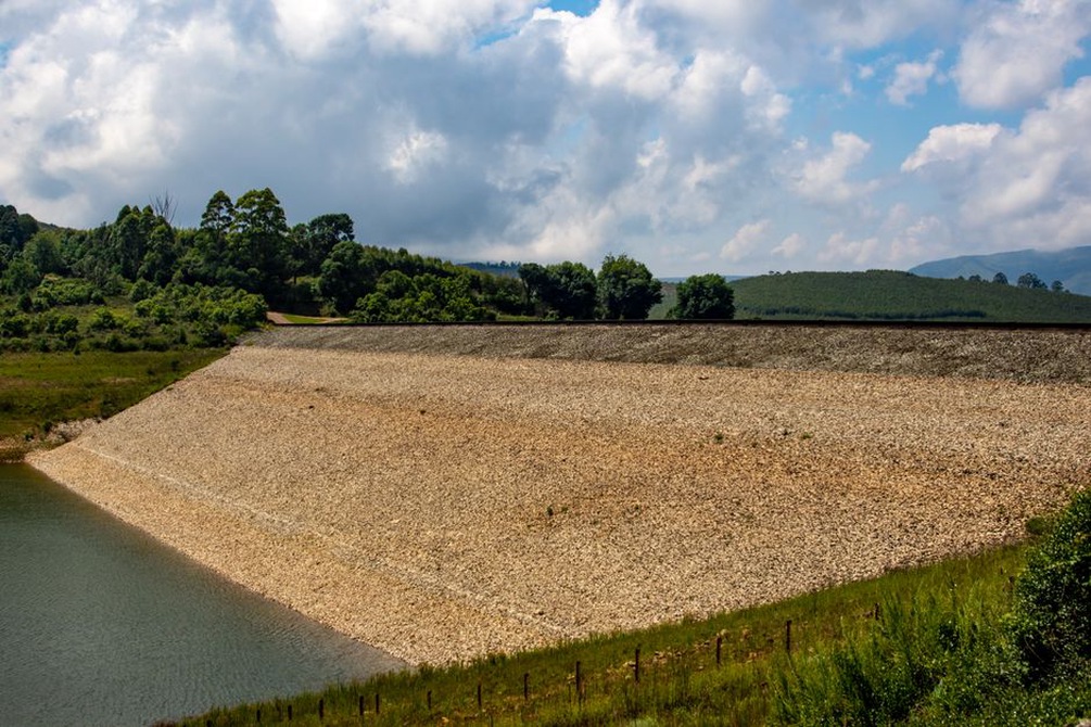
When water levels rise on one side of an embankment, retaining wall, or tunnel lining, a hydraulic gradient develops through the ground and engineered fill. Excessive gradients can cause fine particles to migrate through cracks, poorly graded fill, defects at structures, or inadequate filters. This process, often called internal erosion or piping, can create concealed channels and voids that reduce stability.
Rapid drawdown requires particular attention. Water outside an embankment may recede faster than pore pressures dissipate within it, leaving the slope with lower effective stress and a reduced factor of safety. Instability may then develop after the flood peak, when access is improving and pressure to reopen the route is greatest.
Saturation of pavement, track, and foundations
Repeated wetting weakens some unbound layers and subgrades, particularly where drainage is slow or fines are prone to pumping. Pavement distress may appear as rutting, cracking, edge breakup, settlement, and reduced ride quality. Railway track may experience ballast fouling, loss of confinement, subgrade softening, and differential settlement that affects geometry.
Moisture response is material-specific. Assessments should draw on laboratory and field evidence for permeability, stiffness, shear strength, erosion resistance, and cyclic behaviour. Broad assumptions based on material names alone are not adequate for critical assets.
Start with routes, consequences, and credible events
Flood-resilience planning should begin with the transport function that must be protected. A low-volume local road, a rail freight corridor, an evacuation route, and the only access to a hospital can have very different tolerances for closure. Asset criticality must be considered alongside physical vulnerability.
A useful assessment considers hazard, exposure, vulnerability, and consequence:
- Hazard: flood depth, velocity, duration, rate of rise, sediment load, debris, wave action, groundwater response, and the likelihood of coincident slope failure.
- Exposure: the location and elevation of the route, crossings, portals, substations, pumping stations, access roads, and communications equipment.
- Vulnerability: the susceptibility of foundations, drainage, structural elements, materials, and operational systems to the identified loads.
- Consequence: safety effects, repair duration, network detours, economic disruption, environmental harm, and emergency-service access.
Flood mapping is essential, but it is not enough on its own. Maps may cover only a limited range of return periods, historical conditions, or river flooding. Assessment should also consider pluvial flooding, groundwater, coastal surge where relevant, dam or levee failure scenarios, blocked drainage, and climate-driven changes in rainfall intensity or sea level. For a wider framework on combining hazards and route consequences, see the assessment of natural hazards across transportation networks.
Asset-specific vulnerabilities
| Asset | Typical flood-related failure modes | Key evidence for assessment |
|---|---|---|
| Road embankment | Toe erosion, overtopping, slope instability, culvert washout, pavement loss | Surveyed geometry, ground investigation, drainage condition, high-water marks, erosion records |
| Railway formation | Ballast migration, subgrade softening, formation washout, track misalignment | Track geometry trends, drainage inspections, stiffness testing, settlement and moisture observations |
| Bridge crossing | Foundation scour, bank retreat, debris accumulation, approach settlement, bearing or deck damage | Bathymetry, pier and abutment inspections, channel surveys, scour history, structural monitoring |
| Tunnel and portal | Inflow, uplift, lining leakage, portal slope erosion, failure of pumps or electrical equipment | Drainage and pump tests, groundwater levels, lining condition, portal ground movement, power resilience |
| Retaining structure | Hydrostatic pressure buildup, backfill saturation, toe scour, loss of retained ground | Drainage outlets, wall movement, backfill properties, foundation condition, nearby water levels |
Roads and railways: the importance of drainage continuity
Surface drainage, edge drains, cross-drains, culverts, ditches, and outlet protection operate as a chain. A well-designed inlet offers little benefit if the downstream pipe is blocked, the outlet is undermined, or discharge erodes a sensitive slope. Inspection programmes should record more than whether an asset is present: they should establish whether it passes flow, retains its shape, and discharges safely.
For existing pavements, post-flood repair decisions should be based on investigation of layer condition, moisture damage, voiding, and foundation performance rather than surface defects alone. The methods described in pavement reconstruction investigation, treatment selection, and quality control are particularly relevant where inundation has compromised support beneath a surface that appears repairable.
Bridges: scour is a system issue
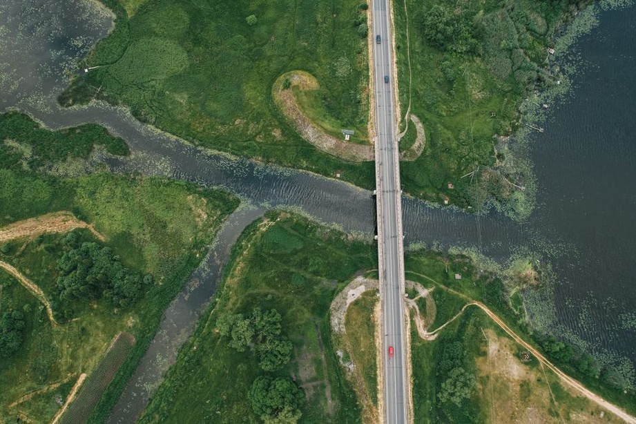
Bridge vulnerability depends on the interaction of channel behaviour, foundations, riverbanks, approaches, and debris. A pier may be structurally adequate while its foundation is exposed by a shifting channel bed. Abutment scour can remove approach support, while flow bypassing an approach embankment can establish an erosion path outside the designed opening.
Post-flood inspections should extend beyond visible superstructure damage. Key checks include channel-bed elevation, bank condition, exposed foundations, approach settlement, displaced protection works, debris accumulations, and altered flow paths. Where scour cannot be observed directly during high water, monitoring and conservative operational restrictions may be necessary until verification is possible.
Tunnels and underground assets
Tunnels may avoid direct surface flooding but remain vulnerable through portals, shafts, ventilation openings, cable ducts, drainage connections, and pressurized groundwater paths. Water ingress can disable traction power, signalling, pumps, communications, and emergency systems before it threatens the primary lining. Flood barriers and pumping capacity must therefore be considered alongside power supply, standby arrangements, remote alarms, access during severe weather, and safe discharge locations.
At portals, concentrated runoff can erode cut slopes, block drains, and carry sediment onto track or roadway. Groundwater pressures and leakage patterns should be interpreted against rainfall and river-stage records rather than treated as isolated defects.
Design and retrofit principles
Resilience measures should reduce both the likelihood of failure and the time needed to detect, isolate, and repair damage. Selection should follow hydrological, hydraulic, geotechnical, structural, environmental, and operational assessment for the specific site. No standard measure is suitable everywhere.
- Preserve or restore conveyance. Provide a coherent path for water, sediment, and debris without creating unacceptable velocities, upstream backing, or downstream erosion.
- Protect vulnerable transitions. Interfaces between embankments and structures, culvert inlets and outlets, bridge approaches, and portal drains often experience concentrated loading and differential movement.
- Control seepage paths. Filters, drainage layers, cutoffs, and properly detailed interfaces can be important, but their performance depends on compatible materials, constructability, and inspection.
- Design erosion protection as a system. Rock protection, mattresses, vegetation, geotextiles, and concrete elements require stable support, suitable filters, durable edges, and allowance for expected hydraulic actions.
- Plan for recovery. Safe inspection access, isolation of electrical equipment, maintainable pumps, replaceable drainage components, and clear repair access can reduce outage duration.
Raising an alignment may be effective where residual overtopping risk is unacceptable, but it can displace floodwater, affect tie-ins, alter drainage, and introduce settlement or approach-gradient constraints. Likewise, increasing culvert capacity without assessing downstream erosion may move the problem rather than resolve it. Major modifications require whole-system hydraulic modelling and geotechnical evaluation.
Monitoring, thresholds, and operational decisions
Monitoring has value only when measurements inform decisions. Rainfall gauges, river-level stations, weather forecasts, piezometers, inclinometers, settlement markers, track-geometry systems, scour sensors, CCTV, pump alarms, and remote power-status signals provide information with different reliability and lead time. Data should be checked for sensor drift, communication loss, and implausible readings before being used for operational action.
Thresholds should be asset-specific and linked to known failure mechanisms. River stage alone may be an inadequate trigger where damage is governed by rate of rise, duration, flow velocity, antecedent saturation, or debris accumulation. Escalation plans should state who reviews alarms, which inspections they trigger, what restrictions are available, and what evidence is required before reopening.
Post-flood inspection before reopening
Reopening is a risk decision, not simply a response to falling water levels. A structured inspection should separate immediate hazards from latent damage. Typical checks include:
- overtopping marks, erosion gullies, slumping, cracking, and settlement on embankments;
- culvert blockage, displaced headwalls, outlet scour, and loss of surrounding fill;
- pavement edge failures, soft areas, void indications, and damaged safety barriers;
- rail ballast loss, formation exposure, drainage washout, and track-geometry deviations;
- bridge debris, bank erosion, approach settlement, changed bed levels, and possible scour;
- tunnel inflow, damaged pumps, contaminated sumps, electrical equipment exposure, and portal instability.
Where evidence indicates ground disturbance, targeted investigation may be needed before normal loading resumes. Depending on the asset and suspected mechanism, this may include survey control, probing, geophysical screening, boreholes, material sampling, underwater inspection, or repeat monitoring during drawdown. Temporary speed, axle-load, or lane restrictions are meaningful only when paired with a defined inspection and verification plan. The reopening record should identify the inspected reach, observed conditions, remaining uncertainties, the responsible decision-maker, and the date or trigger for the next check.