A clear road surface does not prove the slope above it is safe. A shallow slide may leave the carriageway untouched but block a cut-slope drain, raising groundwater pressure before the next storm. On a railway, movement behind a retaining wall may first show up as recurring track-alignment defects. Mitigation has two related aims: reduce the likelihood or reach of slope movement, and prevent movement from becoming an uncontrolled transport incident.
Define the threat at the route, not just on the slope
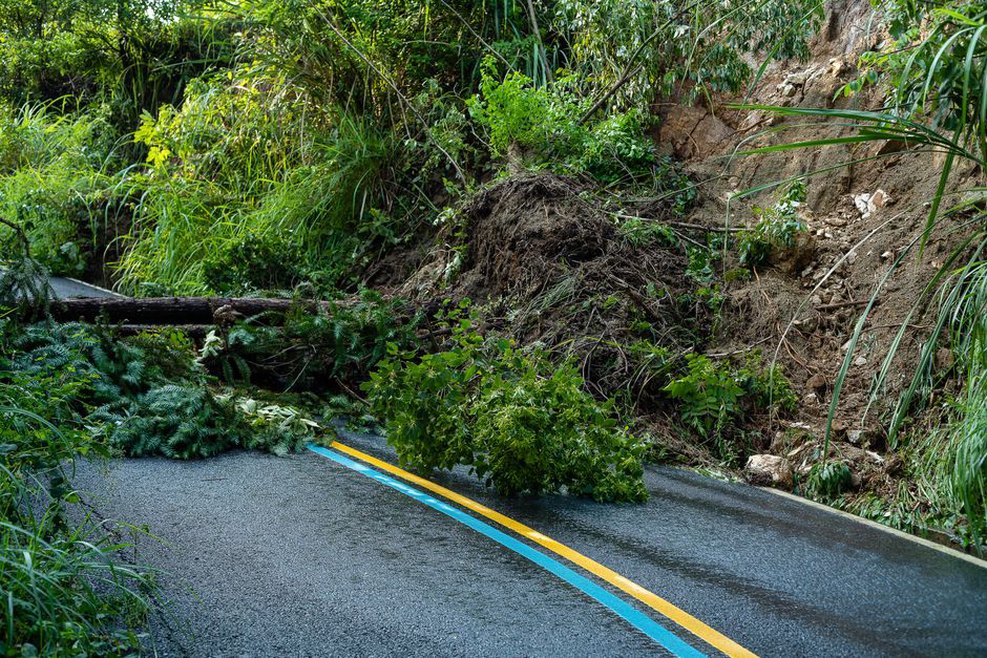
“Landslide” describes movements with different engineering implications. Rainfall infiltration and drainage condition may strongly influence a shallow debris slide in weathered soil. A deep-seated slide may move slowly across a broad area, damaging a route through sustained deformation. Rockfall can arrive with little warning from a source well above the formation. Debris flows may follow channels and enter a corridor at a culvert or bridge opening. Treating all four as one slope-stability problem risks choosing a measure that cannot intercept the hazard.
Distinguish the source area, the travel path and the asset or operation exposed. In a railway cutting, the immediate exposure might be an overhead-line mast, a signal cable or track clearance rather than the rails alone. A road at the foot of a natural hillside may have stable pavement yet lie in the runout path of debris originating outside the right-of-way. Record catchment limits, land ownership and maintenance responsibility alongside the physical hazard: they affect whether a proposed control can be inspected and maintained.
Record credible routes to failure
A corridor inventory is more useful when it describes mechanisms than when it assigns a single unexplained risk label. At each susceptible location, record the material and slope geometry; known or inferred slip surfaces; groundwater and surface-water pathways; signs of past movement; likely triggers; possible travel distance; and assets that could be struck or displaced. Site inspection, terrain mapping, maintenance records, geological information and targeted subsurface investigation each answer different questions. A desktop map can identify a steep hillside, but it cannot show whether a retaining structure’s outlets work or whether a crack is fresh.
Keep the limits of that evidence visible. Vegetation or fill may obscure a landslide boundary mapped from terrain. A borehole describes conditions at its location, not across the whole hillside. One dry-season groundwater reading cannot establish the pressures reached during prolonged rain. These uncertainties belong in the hazard register, particularly when they affect a decision to keep a route open or invest in permanent works.
Prioritize locations by consequence and available warning time
The probability of slope movement is only part of route risk. Similar failures can have very different consequences depending on traffic exposure, operating speed, visibility, escape space, alternative routes and the time available to detect an obstruction. On railways, the length of a controlled section and signal locations affect how quickly an operational restriction can take effect. On roads, queues beneath a slope can increase exposure even if moving vehicles spend little time in the hazard zone.
Screen each site against three questions: What movement is credible? How likely is it under relevant conditions? What happens if material reaches the route or its supporting ground moves? One site may need immediate drain clearance; another may need detailed investigation. A small ditch that repeatedly blocks above an embankment can warrant prompt attention despite the modest-looking slope. A remote rock source with uncertain runout may need mapping and analysis before a barrier location can be chosen.
- High-consequence exposure: limited visibility, high occupancy, critical rail equipment, structures or no practical diversion.
- Evidence of activity: new tension cracks, offset drains, fresh scarps, tilted vegetation, repeated track corrections or pavement deformation.
- Water sensitivity: seepage after rain, saturated fill, blocked outlets or runoff newly concentrated toward a slope.
- Control uncertainty: inaccessible drainage, undocumented old works, unclear ownership or monitoring without a defined response.
These indicators help set priorities; they do not replace site-specific stability and runout assessment. The highest-priority site is not necessarily the tallest slope. It may be a modest one whose debris can reach the route before anyone can detect it or divert traffic.
Reduce the driving mechanisms where feasible
Water management may be a useful first intervention, provided its source and destination are understood. Surface measures can keep runoff out of cracks or prevent toe erosion; subsurface measures can lower pressure within the relevant ground mass. Neither result follows simply from adding a drain. A channel that concentrates water at an unprotected outlet can shift erosion downslope. A perforated drain above the active groundwater path may do little for stability.
Control water without creating a new discharge hazard
Trace where water arrives, accumulates and leaves during intense and prolonged rainfall. Inspect crest ditches, culverts, cross-drains, retaining-wall weep holes, outfalls and erosion protection as parts of one system. Where pathways are unclear, dye tracing, flow observations or piezometric measurements may help. Access for sediment and vegetation clearance is part of the control: a buried or unreachable inlet can fail quietly while the drawing still shows a working drain.
For a proposed new outlet, assess the receiving ground and downstream capacity. Directing road runoff onto a marginal natural slope can undermine an otherwise stable section. After a slide, check drainage repairs against the changed topography; an old outfall position may no longer be suitable.
Alter geometry or support the ground
Flattening an oversteepened slope, removing material from its head or adding resistance near its toe can change the balance of forces. Suitability depends on land availability, geology, construction access, groundwater and the behavior of adjacent infrastructure. Even brief excavation at the toe of an active landslide, such as for a utility trench, can remove support at a critical point. Spoil or equipment placed on the crest can add harmful load.
Engineered options include retaining structures, ground anchors, reinforced earth, piles and localized surface stabilization. They are not interchangeable: each transfers load through different materials and may be ineffective if the controlling failure surface lies below its working depth. Sequencing matters too. A scheme stable on completion may expose the route during excavation or drilling, so temporary works and monitoring must be considered alongside the permanent design. No generic slope angle, drain spacing or support layout can replace a site ground model and engineering assessment.
Vegetation can reduce surface erosion and shallow infiltration in some settings, but roots are not a reliable remedy for a deep-seated slide. Removing trees can change moisture conditions and expose soil. A vegetation plan should distinguish erosion control, inspection visibility and long-term root effects rather than treating planting or clearance as a universal fix.
Intercept debris when preventing release is impractical
Stabilizing a source area may be unsafe or uneconomic on an extensive natural hillside. Route protection may instead aim to stop, divert or accommodate moving material. Rockfall mesh and barriers, catch ditches, debris basins, deflection structures and protective galleries suit different movement types and energy ranges. Choosing among them requires credible estimates of block size or debris volume, velocity, trajectory and where material will collect after interception.
A barrier also needs space and a maintenance plan behind it. Once captured debris fills a catch area, the next event may overtop the system. A debris basin needs safe equipment access and a way to remove sediment and boulders. A protective structure must be assessed for impact and for material piling against it. At culverts and bridge openings, debris blockage can redirect water and sediment toward the route; a structure designed to pass flow may become an obstruction during a landslide.
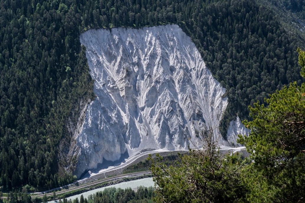
Make runout uncertainty explicit. A mapped historic deposit can indicate a plausible travel path, but later material may behave differently if rainfall, channel blockage or slope geometry changes. If analysis cannot confidently bound travel distance, operational controls may still be needed after physical protection is installed.
Make monitoring lead to a decision
Monitoring may reveal movement before the route is obstructed, but a sensor does not reduce risk by itself. Define the behavior to detect, the lead time needed to act, who receives an alert and who can restrict operations. Observations may include survey targets, crack gauges, inclinometers, piezometers, rainfall measurements, remote imagery and inspections of drains or barriers. Match the instrument to the mechanism: a surface crack gauge is unlikely to characterize a deep slip surface, and a pore-pressure sensor will not detect a falling rock block.
Establish baseline behavior before setting triggers. Seasonal movement or groundwater fluctuation may be normal at a site, so rate of change, persistence and combinations of observations can be more informative than one reading. Check data quality as well. Sensor drift, communication loss, damage and missed manual readings must not be mistaken for stable ground. If operations depend on an alert, loss of the alerting system needs its own defined response.
Connect thresholds to route operations
A response plan may distinguish increased inspection, speed restriction, controlled passage and closure, using criteria selected for the site and its operating conditions. A threshold must leave time to notify operators and allow the last exposed vehicle or train to clear the section. Rainfall triggers can help where past failures show a credible relationship with rain, but they may miss a local pipe leak or movement caused by toe excavation. Field observations and ground measurements reduce reliance on a weather trigger alone.
Give operational teams location-specific instructions: where the hazard zone starts and ends, how to inspect without entering an active runout path, whom to contact and what evidence is needed to reopen. A road closure must account for traffic already between control points. On rail, an inspection report should describe track geometry, formation and adjacent slope condition—not simply state that the rails are clear.
Preserve performance through maintenance and change control
Mitigation measures often lose effectiveness without a dramatic failure. Sediment reduces ditch capacity; blocked wall outlets raise pressure; corrosion or impact damage weakens barriers; erosion removes support at an outfall. An asset register should state each measure’s intended function, inspection access, condition indicators and maintenance owner. Set inspection frequency in light of storm exposure and observed behavior, with extra checks after triggering events rather than calendar visits alone.
Changes near the route warrant the same attention as aging works. New cuttings, utility trenches, drainage connections, stockpiles and uphill land-use changes can alter loads or water pathways. Pavement or track-geometry repairs may restore service while concealing continued ground movement. Repeated defects at the same chainage should prompt a review of the slope and foundation, not another surface correction alone.
Inspect and reopen after a landslide
Clearing debris does not establish that the hazard has ended. An exposed scarp may release more material, saturated ground may still move, and buried drains or damaged barriers may no longer function. Initial assessment should set a safe access boundary, identify ongoing movement and water flow, and document debris extent and route damage before clearance changes the evidence. Remote observation can help when inspectors would otherwise enter a potential second-failure path.
Set reopening criteria for the slope, transport asset and protective measures separately. On a railway, checks may cover formation, alignment, drainage and nearby equipment; on a road, pavement support, retaining elements, culverts and sight lines. Temporary restrictions may be justified while movement and groundwater observations continue. If the slope remains active, defined inspection and closure triggers are more defensible than an informal promise to watch it.
Keep the available rainfall and groundwater observations, the time movement was first reported, debris limits, damage, inspection findings and the basis for reopening in the post-event record. Mark the last confirmed clear location and first affected location on the route plan. Those two observations help refine the hazard boundary before the next storm.