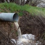
A culvert may pass its design flow yet block with woody debris. A bridge pier may be founded in a channel that later erodes, or a cutting may cross a weak seam missed during the initial investigation. Any of these can interrupt an otherwise well-designed transport corridor. Natural-hazard mitigation is therefore not a single protective measure; it is a project-wide process of identifying credible events, understanding how the ground and assets will respond, and maintaining safe operation when conditions depart from normal.
For roads, railways, bridges, and tunnels, relevant hazards commonly include intense rainfall, river flooding, debris flows, landslides, erosion and scour, earthquakes, extreme heat, freeze-thaw cycles, coastal processes, and ground movement. Their effects are often connected. Prolonged rainfall can increase pore-water pressures, trigger slope movement, obstruct drainage, and redirect flow toward an embankment or bridge approach. Mitigation needs to consider these sequences rather than assess each hazard in isolation.
Start with hazard pathways, not a checklist
A hazard becomes an infrastructure risk through a pathway that links an event to damage, loss of function, or unsafe operation. The same flood depth may have limited consequences on a raised, well-drained road, yet undermine a low approach embankment, inundate electrical equipment, or force closure of a tunnel portal. Early studies should therefore describe four connected elements:
- Hazard source: rainfall, river discharge, unstable terrain, fault movement, storm surge, temperature extremes, or groundwater changes.
- Trigger and mechanism: erosion, slope saturation, liquefaction, rockfall, settlement, debris blockage, thermal movement, or structural vibration.
- Exposure: asset components within the affected area, including drainage outlets, retaining systems, foundations, utilities, access roads, and control systems.
- Consequence: service interruption, reduced load capacity, derailment or collision risk, loss of emergency access, environmental release, or costly reconstruction.
This framework avoids a frequent mistake: designing only for the most visible hazard. A rockfall fence may reduce the risk of direct impact on a road, while doing nothing to prevent fallen material from blocking a ditch and directing runoff onto the carriageway. Likewise, increasing drainage capacity does not automatically improve resilience if the inlet is below an unstable slope or the outlet is likely to erode during high flows.
Build a defensible ground and water model
The quality of the site model governs the quality of natural-hazard controls. Desk studies, terrain interpretation, field mapping, boreholes, trial pits, groundwater observations, geophysical surveys where appropriate, laboratory testing, and records of previous events should be considered together. The aim is not simply to classify soil and rock. It is to identify the materials, discontinuities, water conditions, landforms, and processes that control failure.
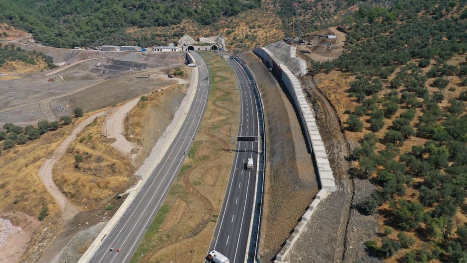
For linear infrastructure, investigation spacing should reflect both ground variability and the consequences of failure. Valleys, stream crossings, old landslide terrain, cut-to-fill transitions, fault zones, karst-prone ground, alluvial deposits, and tunnel portals often require closer investigation than long, uniform sections. Seasonal conditions also matter. Groundwater readings taken during a dry period may not represent pressures after persistent rainfall or snowmelt.
Historical evidence can be particularly useful. Maintenance logs, aerial photographs, local authority records, satellite imagery, old maps, and reports from nearby projects may identify earlier washouts, recurrent icing, channel migration, abandoned quarries, or legacy drainage routes. Such evidence still needs field verification, but overlooking it can produce an unrealistically benign design basis.
Account for uncertainty explicitly
Ground and hydrological models always contain uncertainty. Rather than masking it with a single assumed parameter, project teams should record what is known, what remains uncertain, and which gaps could materially affect the proposed mitigation. Sensitivity checks can indicate whether relatively small changes in groundwater level, material strength, flood level, or scour depth alter the governing failure mechanism.
Where uncertainty cannot be resolved before construction, staged verification, observational methods with defined response actions, or adaptable designs may be needed. This is particularly relevant when excavation exposes geological features that could not be investigated directly, or when a watercourse responds rapidly to seasonal flows.
Match controls to the failure mechanism
Effective mitigation generally combines avoidance, resistance, accommodation, monitoring, and operational planning. Changing the alignment, elevation, crossing location, or portal position may be more dependable than adding increasingly complicated protection within a high-hazard area. Where avoidance is impractical, the selected controls should address the physical mechanism causing damage.
| Hazard mechanism | Infrastructure vulnerability | Typical control categories |
|---|---|---|
| Rapid runoff and debris | Overtopping, blocked inlets, erosion of embankments | Catchment assessment, debris-tolerant drainage layout, erosion protection, maintainable access |
| Slope movement | Loss of support, blocked corridor, retaining-wall loading | Drainage control, geometry changes, stabilization where justified, catch ditches, monitoring |
| River scour and channel change | Foundation exposure, approach washout, bank loss | Hydraulic and geomorphic assessment, foundation protection, allowance for inspection and repair |
| Earthquake-induced ground deformation | Settlement, lateral spreading, bearing failure, joint damage | Site-response evaluation, deformation-compatible details, ground improvement or foundation measures where needed |
| Thermal and freeze-thaw action | Cracking, heave, drainage damage, joint distress | Material selection, moisture management, detailing for movement, seasonal inspection |
Drainage requires particular attention because it influences several hazards at once. Surface water must be intercepted, conveyed, discharged, and dissipated without destabilising slopes or eroding the receiving ground. Subsurface drainage requires an understanding of soil permeability, clogging risk, outlet performance, and maintenance access. Measures that work only when entirely clean or perfectly maintained should be treated cautiously.
For slopes, the design basis should distinguish between shallow erosion, localised slips, deep-seated movement, rockfall, and debris flow. Each has different triggers, runout behaviour, and suitable controls. The investigation and design controls discussed in highway slope stability investigation, design controls and monitoring are particularly relevant where a road alignment crosses variable terrain.
Design for serviceability and recoverability
Natural-hazard performance is not limited to preventing collapse. A corridor may remain structurally intact yet be unusable because drainage is blocked, approach slabs settle, track geometry deteriorates, power equipment floods, or inspection access is lost. Performance objectives should distinguish life safety, damage limitation, continued operation, and acceptable recovery time.
Critical assets need to be considered as systems. A bridge may survive a flood while its only access road is overtopped. A tunnel may resist ground loading, but portal drainage may still allow water into electrical rooms. A railway embankment may remain stable but require speed restrictions because settlement affects track geometry. Redundancy, alternative access, modular repair components, spare drainage capacity where justified, and safe inspection points can reduce disruption after an event.
Constructability also influences resilience. Complex details are vulnerable when contractors cannot inspect, compact, test, or maintain them reliably under site conditions. Temporary works, construction-stage drainage, excavation sequencing, and weather-related hold points deserve the same engineering attention as permanent works. Disturbing a slope, redirecting runoff, or leaving exposed soils ahead of a storm can create a hazard that was absent before construction.
Use monitoring as a decision system
Monitoring is useful only when it answers a defined operational question. Instrumentation without thresholds, baseline readings, ownership, or response procedures can generate data without improving safety. At hazard-prone locations, a monitoring plan should identify failure indicators, measurement frequency, data-quality checks, alert levels, responsible personnel, and the actions associated with each alert.
Measurements may include rainfall, water level, pore-water pressure, ground displacement, inclinometer movement, settlement, crack width, vibration, temperature, or scour-related bed-level change. Remote observations can extend coverage, but site inspection remains necessary to establish whether an apparent anomaly indicates deterioration, a sensor fault, or changing environmental conditions. Monitoring equipment also requires maintenance and recalibration throughout the asset life.
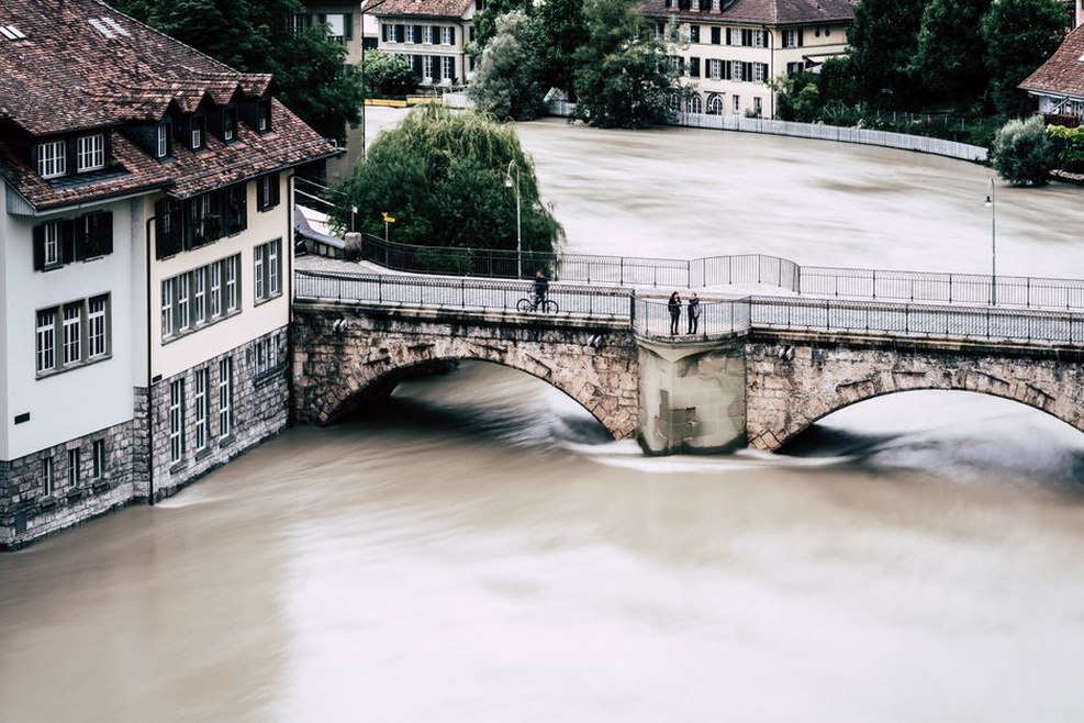
For bridges exposed to flooding, hydraulic behaviour, foundation vulnerability, and inspection planning must be considered together. Flood-resistant bridge design: scour, hydraulics, and inspection addresses these linked considerations in more detail.
Connect design assumptions to operations
Hazard mitigation can fail after handover when assumptions made during design are not passed to the owner and maintenance teams. Asset records should identify drainage routes, protected slopes, inspection locations, design limitations, monitoring thresholds, and features that need periodic clearing or renewal. A blocked outlet, damaged riprap layer, sealed weep hole, or unauthorised excavation near a retaining system can substantially alter the risk profile.
Emergency plans should be based on plausible triggers and observable conditions. These may include rainfall thresholds combined with known saturated ground, river levels approaching defined inspection criteria, measured movement trends, debris accumulation, or earthquake reports. The response does not always require full closure. It may involve targeted inspection, speed restrictions, traffic management, or pre-positioned repair resources. Decisions should be traceable and compatible with the asset owner’s safety management system.
Post-event reviews should test performance against the assumed failure mechanism rather than simply record visible damage. If a culvert conveys water but erosion develops at its outlet, the next step is to reassess outlet hydraulics, receiving-ground resistance, and maintenance conditions. If a slope movement alarm coincides with rising pore pressure, subsequent investigation should examine whether drainage capacity, groundwater pathways, or geological boundaries differ from the original model. That evidence provides a stronger basis for setting the next inspection interval, defining a repair scope, or deciding whether an upgrade is needed.