A highway may meet its geometric and pavement specifications and still deteriorate early if the ground model is wrong. Differential settlement at an embankment transition, subgrade softening after seasonal wetting, or lateral movement in a cut slope can lead to recurring roughness, cracking, drainage damage, and safety restrictions. Geotechnical work provides the evidence and controls needed to fit a road corridor to the terrain it crosses.
For highway projects, geotechnical engineering extends well beyond bearing capacity beneath the pavement. It informs route selection, earthworks, pavement support, retaining structures, drainage, bridges, culverts, construction staging, and long-term asset management. The task is to establish how soil, rock, groundwater, and geological hazards will respond to construction, traffic loading, weather, and time.
Building a ground model before designing the road
The starting point is a ground model: a reasoned representation of strata, material properties, groundwater conditions, landforms, and hazards along the proposed alignment. It draws on desk studies, site reconnaissance, intrusive investigation, in-situ and laboratory testing, geophysical data where appropriate, and records from nearby construction.
A useful model does more than classify layers as clay, sand, or rock. It identifies features that govern engineering behaviour:
- depth, continuity, and variability of weak or compressible deposits;
- strength and stiffness of natural ground, fill, weathered rock, and intact rock;
- groundwater levels, seepage paths, artesian pressures, and seasonal variation;
- organic soils, uncontrolled fill, voids, soluble rock, and contaminated ground;
- faults, adverse rock discontinuities, unstable slopes, and evidence of past landslides;
- materials potentially suitable for earthworks, or likely to degrade when excavated or wetted.
Ground variability matters as much as the conditions identified at individual investigation points. Boreholes and test pits provide discrete observations; they do not prove that the same conditions persist between them. The design team must interpret likely continuity and manage the remaining uncertainty. Locations where ground failure would have greater consequences—bridge approaches, deep cuttings, high embankments, interchanges, and drainage crossings—usually need more detailed investigation and closer observational control during construction.
Investigation is phased, not a one-time exercise
Early investigations support corridor selection and identify constraints that could make one alignment substantially more difficult than another. Later work refines design parameters, identifies construction risks, and assesses borrow sources or excavated materials. Verification continues during earthworks: exposed faces, proof rolling, trial sections, groundwater observations, and material classification may reveal conditions that the original investigation did not capture.
This sequence avoids treating sparse data as design certainty. A register of assumptions, uncertainties, and verification measures gives designers, contractors, and asset owners a shared basis for decisions.
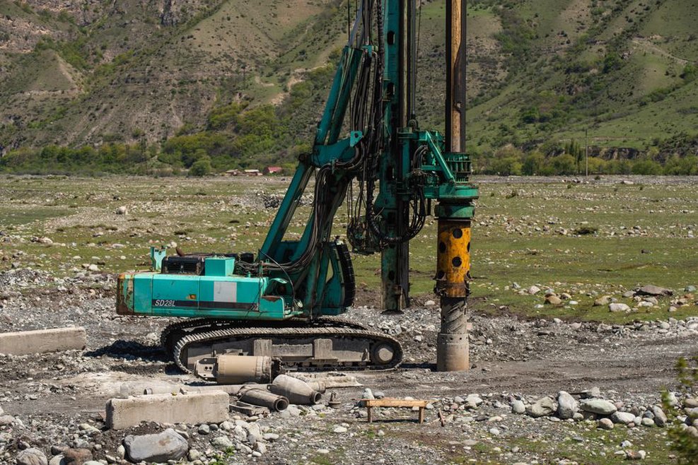
Subgrade behaviour and pavement performance
The pavement distributes wheel loads, but its long-term condition depends on the support and moisture state of the layers below. A subgrade with low strength, excessive deformability, frost susceptibility, or poor drainage can contribute to rutting, fatigue cracking, surface deformation, and declining ride quality. Relevant design inputs may include stiffness, shear strength, density, grading, plasticity, permeability, moisture sensitivity, and susceptibility to volume change.
Geotechnical assessment distinguishes between a material’s condition during testing and its likely condition in service. Fine-grained soils can appear competent when dry and lose strength after infiltration. Some expansive clays shrink and swell as moisture changes. Frost-susceptible soils may form ice lenses under suitable thermal and moisture conditions, causing heave and later weakening during thaw. In these cases, drainage and earthworks details can matter as much as nominal pavement-layer thickness.
Heavy traffic makes dependable support more important because repeated loading accumulates damage in pavement systems. The relationship between wheel loading, pavement distress, and assessment methods is examined in how heavy traffic damages roads through load-related pavement failure. Geotechnical design addresses the ground-related part of that assessment: whether the support platform can remain uniform and stable under expected loading and environmental conditions.
Earthworks form the working platform
Highway formation may comprise natural ground, engineered fill, improved subgrade, or a combination of these. Earthworks specifications commonly define acceptable materials, moisture ranges, lift thicknesses, compaction requirements, testing frequencies, and procedures for unsuitable ground. Compliance testing alone, however, does not remove all risk. Compaction must be adequate and reasonably uniform, drainage paths must remain functional, and the foundation beneath placed fill must not move beyond acceptable limits.
Where poor soils are encountered, possible measures include removal and replacement, staged embankment construction, drainage, reinforcement, ground improvement, lightweight fill, or structural bridging. The appropriate choice is project-specific. Its effectiveness depends on soil type, groundwater, embankment geometry, construction access, available consolidation time, and the consequences of residual settlement. A generic detail should not be adopted without confirming site conditions and performance criteria.
Settlement, transitions, and deformation control
Settlement can be acceptable in absolute terms yet damaging when it changes sharply over a short distance. This makes transitions particularly important: embankments at bridge approaches, culverts beneath fills, widened sections beside older pavement, and points where soft deposits give way to dense ground or rock. Differential movement can create a bump, concentrate stresses in pavement layers, disrupt drainage gradients, and increase maintenance demand.
For compressible soils, design considers immediate deformation as well as time-dependent consolidation and creep. Fill loading may raise pore-water pressure in low-permeability soils, temporarily reducing effective stress and shear strength. If construction advances too quickly, instability may develop before drainage and strength gain occur. Where analysis and field response justify them, staged construction, surcharge, vertical drainage, and instrumentation may be used.
Monitoring tests assumptions about ground response against measured behaviour. Settlement plates, inclinometers, piezometers, extensometers, and survey points can show whether deformation, lateral movement, and pore pressures are developing as expected. An overview of advances in soil monitoring for transport infrastructure provides useful context for selecting monitoring methods and interpreting their operational role.
Cuttings, embankments, and retaining systems
Earthworks alter a site’s natural stress and drainage conditions. In cuttings, excavation removes support and may expose weathered zones, weak layers, discontinuities, or seepage planes. In embankments, added load can cause foundation settlement, lateral spreading, or failure along weak strata. Slope design therefore depends on geology, groundwater, geometry, loading, erosion exposure, vegetation, drainage, and uncertainty in the available data.
Drainage is a geotechnical control rather than simply a hydraulic accessory. Surface water can erode slopes and infiltrate cracks. Groundwater can reduce effective stress, create uplift pressures, or emerge as seepage that degrades a slope face. Interceptor drains, lined channels, filter-compatible drainage layers, toe drains, and erosion protection need to work together so water is collected, conveyed, and discharged without causing internal erosion or downstream instability.
Retaining walls and reinforced soil structures also depend on the ground behind and beneath them. Design must address external stability, internal stability where reinforcement is used, foundation performance, drainage, construction sequence, surcharge loading, and material durability. Wall movement can affect pavement, buried services, and adjacent structures even without ultimate collapse. Geotechnical parameters should reflect the drainage condition and construction stage being assessed, rather than relying on a single unconservative value.
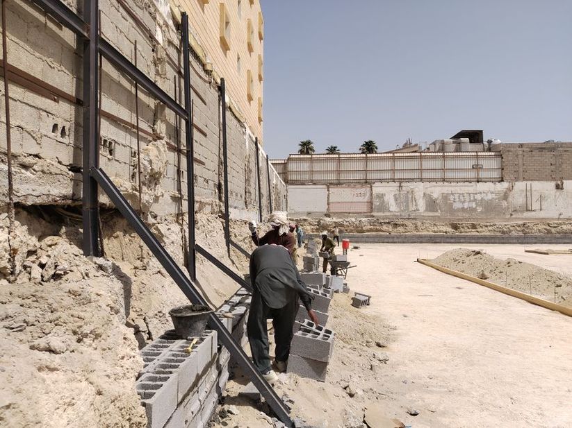
Structures and drainage crossings along the corridor
Bridges, underpasses, culverts, and sign gantries introduce concentrated loads and foundations that behave differently from nearby embankments. Foundation selection and detailing depend on estimates of bearing resistance, settlement, lateral response, scour-related ground loss at watercourses, and the practicality of excavation or piling. At bridge approaches, the contrast between stiff structural supports and more deformable roadway fills remains a recurring serviceability concern.
Culverts also need careful ground assessment. Bedding, side support, backfill compaction, and susceptibility to flotation or differential settlement affect structural performance. Water passing through or around a crossing can erode soil, particularly where filters, joints, outlet protection, or drainage transitions are poorly detailed. Geotechnical and hydraulic designs should use shared assumptions about water levels, flow routes, erosion potential, and maintenance access.
Geological hazards and resilience
Highway alignments may encounter hazards that extend beyond routine subgrade design. These include landslides, rockfall, debris flows, karst, mining-related subsidence, liquefaction-prone deposits, collapsible soils, and seismic ground deformation. The response may range from avoiding the hazard through alignment selection to mitigation, monitoring, and emergency planning. Decisions should consider the likelihood of occurrence, potential failure extent, exposure of road users, availability of diversion routes, and the practicality of inspection and maintenance.
Climate conditions can alter the severity of these hazards. More intense rainfall may raise pore pressures and increase erosion. Extended dry periods can desiccate shrinkable soils, while freeze-thaw cycles can damage exposed rock and weaken pavement support. Rising groundwater may alter drainage performance. Resilience therefore depends on more than initial strength: drains need to remain accessible, outlets inspectable, critical slopes protected, ground records retained, and monitoring systems linked to clear action thresholds where they are installed.
Construction control and the observational approach
Geotechnical intent can be lost when the materials placed in the works differ from those assumed in design. Construction quality management should verify formation condition, excavation faces, fill-source characteristics, moisture control, compaction, drainage installation, reinforcement placement, and interface details at structures. Unexpected groundwater, soft spots, or newly exposed weak seams should be assessed through the project’s change-control process rather than corrected informally in the field.
Where uncertainty is significant, an observational approach can be effective if planned in advance. It requires defined acceptable performance, instrumentation suited to the anticipated failure modes, baseline readings, threshold values, pre-agreed actions, and authority to modify the works. Monitoring without action criteria is merely data collection; action criteria without dependable measurements do not provide control.
| Highway element | Key geotechnical concern | Typical evidence or control |
|---|---|---|
| Pavement formation | Variable support and moisture sensitivity | Material testing, formation inspection, drainage verification |
| Embankment | Settlement, pore-pressure rise, foundation instability | Staged works, settlement and pore-pressure monitoring |
| Cut slope | Weak layers, seepage, rock discontinuities | Face mapping, groundwater control, slope inspection |
| Bridge approach | Differential settlement and transition roughness | Settlement analysis, fill control, post-construction surveys |
| Culvert crossing | Backfill performance and erosion around the structure | Compaction records, filter details, outlet inspections |
A practical handover record should identify the final ground model, areas of treated or unsuitable ground, fill sources and placement records, drainage routes, monitoring locations, residual risks, and inspection requirements. If settlement markers at a bridge approach remain active after opening, their survey schedule and intervention thresholds should pass to the maintaining authority alongside as-built coordinates and the design predictions used for comparison.