Wave action, tidal currents, runoff, and wind-driven overtopping can progressively remove the ground supporting a road’s outer lane even when the pavement itself appears sound. The critical mechanism is often loss of embankment toe support. As erosion steepens a coastal slope or forms a scour hollow, cracking, settlement, and sudden edge collapse may follow with little warning.
Protecting a coastal road calls for a corridor-scale engineering response. Shoreline behaviour, nearshore hydraulics, ground conditions, drainage, road geometry, environmental constraints, construction access, and inspection capacity all need to be considered together. A wall placed at the pavement edge may conceal the immediate problem while reflecting wave energy, promoting scour at its base, or shifting failure to unprotected ends.
Start with the erosion mechanism, not the protection type
“Coastal erosion” covers several processes, each with different implications for road assets. Their relative importance can change with the season and after storms. A defensible design starts by identifying the active processes and the sequence of events that could threaten road serviceability.
| Process | Typical road consequence | Key investigation need |
|---|---|---|
| Wave attack and toe scour | Removal of material at the embankment or cliff toe, leading to slope instability | Water levels, wave climate, bathymetry, bed material, erosion history |
| Overtopping | Surface erosion, debris deposition, pavement saturation, safety closures | Extreme water levels, wave run-up, crest levels, drainage routes |
| Cliff recession | Progressive loss of setback distance and potential rotational or planar failure | Geological model, discontinuities, groundwater, retreat rates |
| Longshore sediment transport disruption | Beach lowering or erosion concentrated beside structures | Sediment budget, shoreline morphology, seasonal beach profiles |
| Drainage-driven erosion | Gullies, piping, saturation, erosion behind revetments or walls | Catchment flows, outfalls, filter compatibility, groundwater levels |
Historic aerial photographs, survey records, maintenance reports, storm observations, and local knowledge can indicate whether shoreline retreat is episodic or persistent. These sources need to be read alongside current topographic, bathymetric, geological, and hydrodynamic data. A beach that looks wide during a calm-season inspection may offer far less protection after storm-driven drawdown.
Design water levels should account for tides, storm surge, wave setup, run-up, and plausible future sea-level conditions over the intended asset life. The acceptable performance state also needs to be explicit. A strategic route may need to remain open through frequent events, whereas a lower-volume road may allow managed closures during severe overtopping if the formation remains safe and can be restored.
Establish the road’s failure pathways
A coastal road is an integrated earth structure, not simply a strip of pavement. Investigations should establish both how the shoreline may change and how that change could affect the road formation, drainage, and utilities. Boreholes, trial pits, laboratory testing, geophysical surveys where appropriate, and surveyed cross-sections can define weak layers, fill quality, groundwater conditions, and potential slip-surface geometry.
Geotechnical and hydraulic interactions
Wave action can remove toe material while rainfall or overtopping raises pore-water pressures within an embankment. Together, these processes may reduce slope stability more severely than either acting alone. Fine-grained fills are especially vulnerable where drainage is poor. Granular embankments may lose material through internal erosion if filters and drainage transitions are inadequate.
Protection works can also change groundwater behaviour. An impermeable seawall may obstruct drainage from the landward side unless weep holes, drainage layers, collectors, and controlled outfalls are designed as one system. These details must prevent fine soil particles from migrating. A drain discharging through armour without a suitable filter can create a concealed preferential flow path and progressively remove support.
Asset exposure beyond the carriageway
Shoulders, safety barriers, footways, culverts, signs, lighting foundations, utility trenches, and retaining structures may fail before the carriageway does. Edge cracking is an important warning sign, but it is usually a late-stage symptom. Survey programmes should identify changes in beach elevation, toe geometry, wall movement, slope displacement, and drainage performance before deformation reaches the road surface.
Coastal hazards often interact with wider climate stresses. The analysis of changing flood, drainage, heat, and ground risks in Climate Change Risks for Transport Infrastructure: Ground, Drainage, Heat and Flood Resilience is relevant when setting future loading scenarios and maintenance demands.
Categories of engineering response
No single measure suits every site. Effective schemes often combine alignment planning, sediment management, hard protection, slope works, and operational controls. Selection should reflect lifecycle performance and likely effects on adjacent shorelines, rather than initial construction cost alone.
1. Setback, realignment, and elevation
Moving a road landward or raising a vulnerable section can be the most dependable long-term option where space, terrain, property, and network function allow. Setback increases the buffer between the road and an eroding edge. Raising the road can reduce overtopping frequency, though it may introduce new issues involving embankments, access, visual impact, drainage, and wind loading.
Realignment avoids permanent dependence on a defence line where recession rates are high or cliffs are unstable. It is more than a route-design exercise: abandoned sections can still affect coastal access, drainage, contaminated land, utilities, and erosion patterns. Phased realignment may maintain traffic operations while the new route is built, but it requires careful transition planning and erosion-risk management during construction.
2. Rock revetments and armour systems
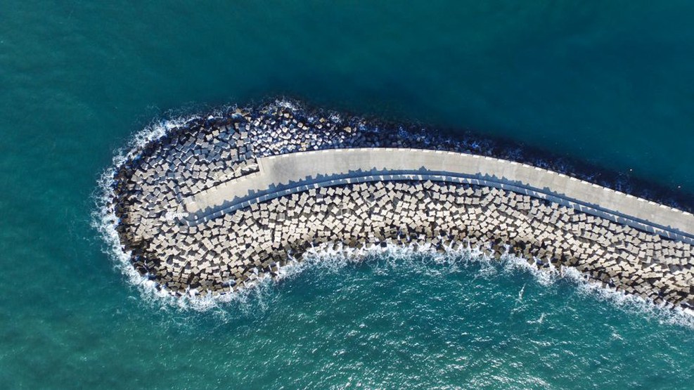
Rock armour revetments dissipate wave energy over a rough, permeable slope. They are commonly used to protect embankment toes and can accommodate limited local settlement when supported by suitable underlayers and toe protection. Performance depends on armour stone size and shape, slope geometry, gradation, filter design, crest treatment, and toe embedment below anticipated scour levels.
A revetment is not simply a loose layer of large rocks. Armour instability, bedding-layer washout, geotextile damage, and toe undermining can each lead to progressive loss of protection. Design requires wave and water-level analysis, site-specific geotechnical assessment, and constructability checks for placing and inspecting stone. Repair access should be planned before the road edge is at risk.
3. Seawalls, bulkheads, and retaining structures
Vertical or near-vertical structures may be necessary where the corridor is constrained by buildings, steep terrain, port facilities, or limited right-of-way. They can retain fill and create a defined boundary, but reflected wave energy may scour the foreshore and undermine foundations. A wall therefore needs an appropriate foundation concept, toe scour protection, drainage provisions, structural redundancy where justified, and measures to manage end effects.
Damage can concentrate at the transition between a rigid wall and a softer embankment because of differential movement. Wall returns, culvert outlets, parapets, and pavement interfaces need the same care as the main wall section. Structural condition inspections should check for cracking, rotation, joint opening, settlement, exposed foundations, and voids behind the face.
4. Beach nourishment and dune-based buffers
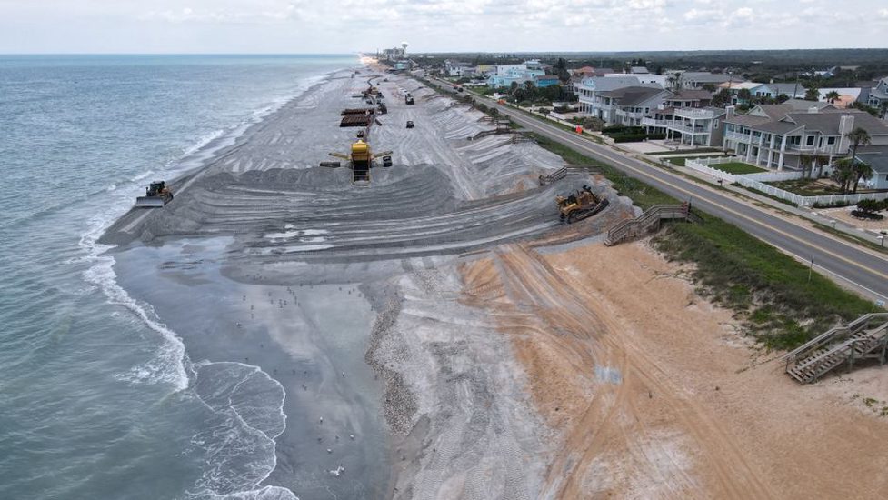
Where coastal processes and sediment availability permit, a maintained beach or dune system can reduce wave energy before it reaches the road. Beach nourishment uses compatible sediment to widen or raise the beach profile. Dunes can provide an elevated sacrificial buffer, particularly where appropriate vegetation and managed access help stabilise them.
These measures may be less visually intrusive and can retain coastal functions, but they need regular monitoring and periodic replenishment. Viability depends on a sound sediment-budget assessment. Imported material may disperse quickly when placed outside the natural transport regime. Nourishment also does not remove the need to manage road drainage and overtopping.
5. Drainage, erosion control, and slope reinforcement
Road runoff can accelerate erosion where it is discharged directly onto a coastal slope without energy dissipation. Cross-drain outlets should be located and detailed to avoid concentrated erosion, backflow during high water, and toe destabilisation. Suitable measures may include lined channels, stilling arrangements, protected outfalls, non-return devices where hydraulically suitable, and properly designed filters.
Where slopes have already been affected by marine erosion, stabilisation may involve regrading, reinforced soil, retaining systems, soil nails, anchors, drainage, or toe protection. The right measure follows from the failure mechanism and ground model. Reinforcing an upper slope without addressing active toe scour can create a false sense of security while the driving process continues.
Design checks that prevent common failures
- Check the full event sequence. Consider elevated water levels, waves, overtopping, rainfall, drainage blockage, drawdown, and traffic loading where they may occur together.
- Protect the toe and transitions. A stable armour face is not enough if scour can pass beneath it or around either end.
- Design filters deliberately. Filter layers and geotextiles must retain underlying soil while allowing drainage. Material compatibility and possible installation damage need assessment.
- Provide maintainable drainage. Place chambers, outlets, and cleaning access where they can still be used after storms and are not located in rapidly eroding ground.
- Allow for inspection and repair. Armour displacement, beach lowering, cracked drainage outlets, and local scour require visible indicators and accessible repair methods.
- Assess adjacent impacts. Coastal structures can alter wave reflection and sediment movement, shifting erosion to neighbouring frontage.
Monitoring and intervention thresholds
Monitoring should support specific decisions rather than produce data without a response plan. Baseline surveys before construction establish reference beach profiles, crest elevations, wall geometry, and slope conditions. Inspections are usually intensified after storms, unusually high water, or observed pavement distress.
Useful techniques include repeat topographic and bathymetric surveys, fixed-point photography, drones used under an engineering validation plan, crack mapping, inclinometers, piezometers, settlement points, and survey targets on retaining structures. Remote data can identify change efficiently, but it does not replace ground verification of voids, drainage condition, material loss, or structural damage. Practical limits and validation needs are examined in Remote Sensing for Transport Infrastructure: Uses, Limits and Engineering Validation.
Intervention thresholds should relate to measurable conditions: loss of toe cover below a specified level, armour-unit displacement, reduced beach width, wall deformation, growth of edge cracks, rising pore pressure, or a defined residual distance between the erosion scarp and road formation. A threshold is useful only when it assigns responsibility, inspection frequency, traffic restrictions where necessary, and a pre-agreed repair action.
Construction and maintenance considerations
Coastal construction is constrained by tides, weather windows, ecological restrictions, and limited access. Temporary works must remain stable through changing water levels and must not obstruct drainage paths or leave the site exposed during staged construction. Material placement quality is critical: exposed geotextiles, segregated filters, poorly seated armour, and incomplete toe trenches may not be visible from the road surface.
For an existing coastal road with new edge cracking, the immediate field response should usually begin with a surveyed crack record, traffic loading controls where support is uncertain, inspection of the seaward slope and drainage outlets, and a post-tide check for fresh scour or voids. Filling the crack before determining whether the embankment toe has been lost can hide further progression while support continues to deteriorate.